 Motivations (slides for context, whiteboard for heat flux method?)
1995 Field Work Synopsis
-
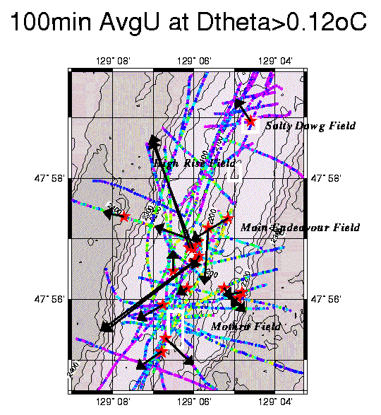
Spatial Orientation: survey coverage, background casts, and current meter locations
How can this work be meaningfully combined with the chemical and biological analyses?
Can diffuse flow be mapped using the combined anomaly and advection data?
Are there physical oceanographic theories that would allow more intelligent spatial extrapolation of the current meter measurements?
Can plume formation theories be tested with these data, analyzing each plume's dimensions and distance from it's supposed source?
The anomalies represent heat from the ridge
Typical theta-S hydrocast in the Northeast Pacific Ocean
Typical theta-S "tow-yo" above the Endeavour Segment
An Example:
The CTDT data reflect 4 known sources (more or less)
Main Endeavour
Mothra
Salty Dawg
Sometimes all 4! MZ1t03
The current data show movement at scales of CTDT tows
Indiscriminant instantaneous heat flux estimates will be variable!
The conservative stance: 4 consecutive tows near the meter
mz1t24
mz1t25
mz1t26
mz1t27
Questions and next steps
Should I continue to seek opportunities to estimate instantaneous
heat flux clearly associated with a known vent field? Or should I
focus first on estimation of a regional, mean flux for the survey period
(following Thomson, et al, 1992)? What about isolating a volume near
the current meter mooring -- only the MEF vicinity, for instance?