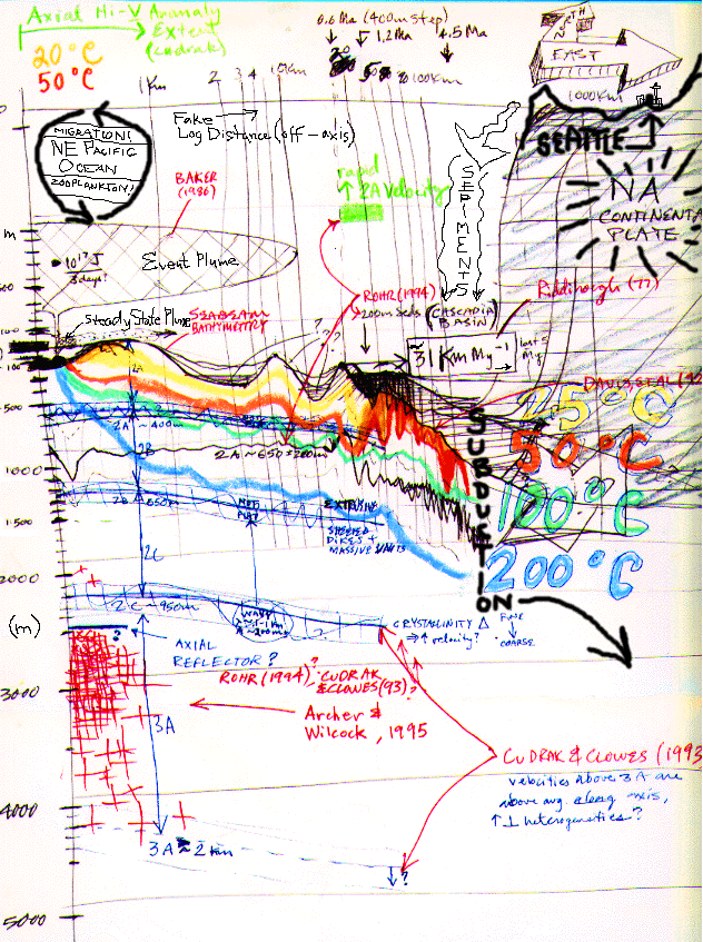
Medium Resolution Sketch
This picture has a lot of ideas in it! I began with a rough scrawl of the SeaBeam bathymetry from the crest of the Endeavour segment, down the flank, across the field sites of Rohr (1994), and on down into the Cascadia Basin and subduction zone where the Juan de Fuca oceanic and North American continental plates are intermittenly(!) sliding past each other. As I work through papers -- especially when they span disciplines -- I find that a little artwork can go a long way towards remembering all the pieces and putting them together neatly. As you can see, the technique is less than refined!
Here is a higher (~560k) resolution version, as well.
Enjoy!
Someday (soon?) this will be a clickable map...